Cypress Grove Research Center and Tomales Bay preserves

Visiting the Tomales Bay Preserves
Cypress Grove Research Center and the Tomales Bay preserves are generally closed to the public as wildlife sanctuaries. Visitors can request an appointment by emailing the preserve manager.
Fee: Suggested donation of $20 per person; $15 for members. All donations are greatly appreciated, and support Audubon Canyon Ranch preserves and programs.
Mailing Address:
PO Box 808
Marshall, CA 94940
415-663-8203
[email protected]
By appointment only:
20545 Shoreline Highway 1
Marshall, CA 94940
ACR Preserves dot the Tomales Bay Shoreline
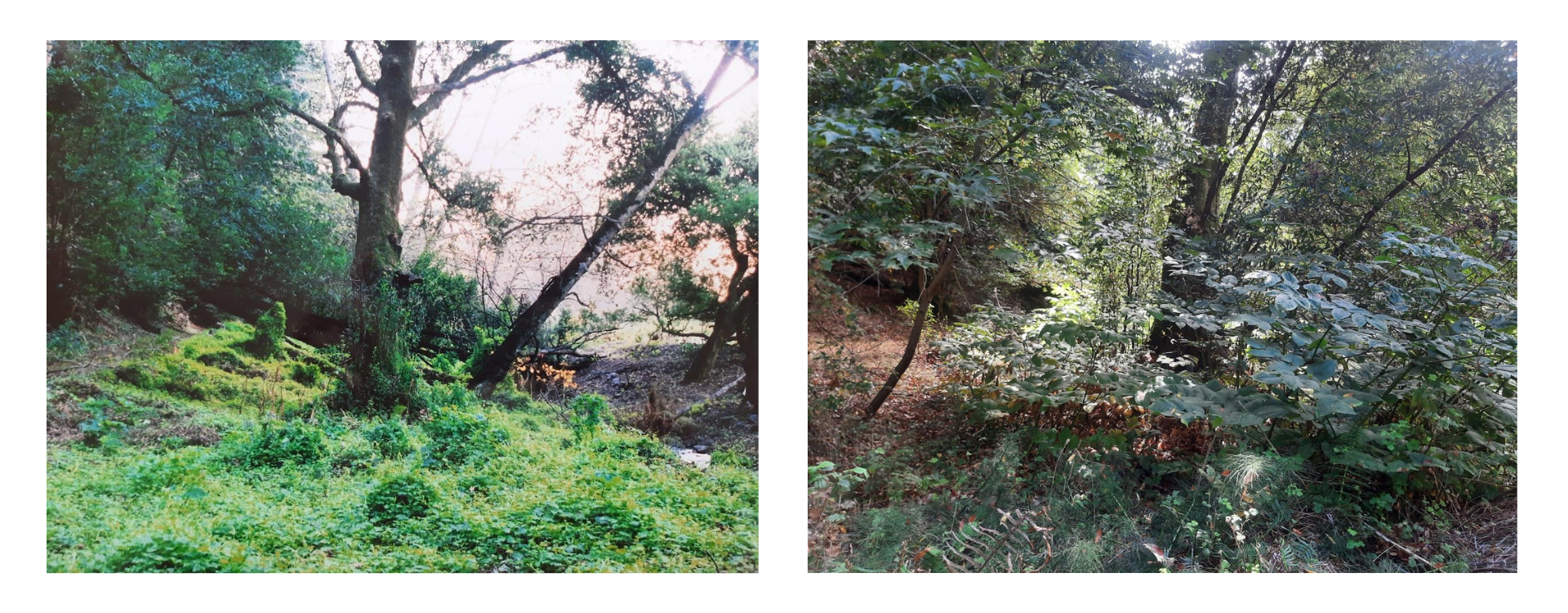
Audubon Canyon Ranch preserves along both the east and west shores of Tomales Bay total roughly 400 acres and are within the ancestral territories of the Coast Miwok peoples. The terrain includes sandy beaches, mudflats, tidal wetlands, marshes, coastal bluffs, and grasslands — most notably at Cypress Grove, Toms Point, Walker Creek Delta, and Olema Marsh. We collaboratively steward these properties as sanctuaries to minimize disturbance, supporting wildlife habitat, biodiversity, and climate resilience.
Cypress Grove Research Center—the perfect hub to study ecology at many scales
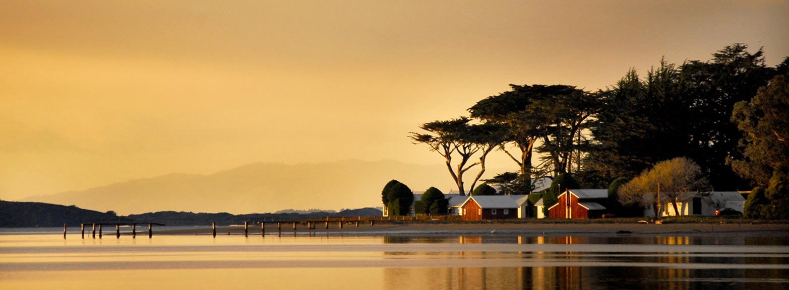
Surrounded by towering Monterey Cypress and wind swept hedges, the delicate Victorian-era cabins built on Cypress Point shimmer at the edge of Tomales Bay, contrasting sharply with the surrounding wildness of the eelgrass beds, native grasslands, and coastal marshland.
Located just north of the town of Marshall, the original 10-acre preserve was donated to Audubon Canyon Ranch in 1971 by Clifford Conly to house its Conservation Science program. With additional support from donors, several adjacent parcels were purchased, including marshland on both sides of Cypress Grove to be protected from the threat of development.
Today, Cypress Grove Research Center includes roughly 100 acres centrally located on the east shore of Tomales Bay and provides a hub for scientists, colleagues, students, and volunteers who conduct long-term monitoring and shorter-term research projects.
Toms Point
Toms Point, characterized by its beak-shaped headland jutting west across Tomales Bay, encompasses 70 acres of coastal sand dunes, scrub, native grasslands, and salt marsh. The preserve offers significant habitat for wildlife, songbirds, and raptors, good tidal foraging for the area’s abundant herons and egrets, as well as undeveloped coastline for wintering shorebirds. Since 1985 Audubon Canyon Ranch has protected Toms Point from development.
Archeological excavations have also shown the cultural importance of places like Toms Point — both historic and contemporary — to native people of California. Excavated artifacts from Toms Point show that Coast Miwok and Southern Pomo Indians carried on their traditions and maintained tribal ties throughout and beyond California’s destructive colonization. Today, the preserve continues to hold cultural significance for Indigenous people.
One example of collaborative stewardship on the preserve includes a partnership with the Invasive Spartina Project to eradicate S. densiflora, an invasive cordgrass that can threaten wetlands by eliminating open areas used for foraging, particularly by birds. Like many historic coastal prairies along the California coast, coyote brush and coastal bush lupine have out-competed native bunch grasses and wildflowers in some areas of the preserve and remain a good candidate for prescribed disturbance to maintain the native coastal prairie grasslands.
Walker Creek Delta
Marsh estuary where Walker Creek meets Tomales Bay. Walker Creek encompasses a 76-square-mile watershed of rural farms and rangelands that drain into Tomales Bay, one of California’s richest and most diverse coastal habitats. The watershed is home to steelhead trout and coho salmon, the endangered freshwater shrimp, red-legged frogs, and many other aquatic species. Audubon Canyon Ranch stewards roughly 100 acres of the tidally influenced floodplain where the creek transitions into the bay adjacent to mudflats used for aquaculture Rare salt marsh vegetation acts as a buffer, filtering nutrient and sediment from upstream, while providing a transition zone and important resting and foraging area for shorebirds, waterfowl, herons, egrets, and raptors.
Olema Marsh
Two hundred years ago, the 40-acre Olema Marsh at the southern end of Tomales Bay was part of an extensive delta salt marsh extending up Bear Valley and Olema Valley from the mouth of Lagunitas Creek. In the early 1900s, a levee was constructed across these valleys to create Levee Road (a short section of Sir Francis Drake Boulevard), cutting off tidal influences from Lagunitas Creek. In the 1980s we began work to restore natural hydrologic circulation in the marsh. The marsh was later included in the larger 560-acre Giacomini Wetlands restoration project completed in 2009. Public access along the National Park Service Olema Marsh Trailhead parallels and overlooks this Audubon Canyon ranch parcel.
Related Content
- Submitted by admin
- February 9, 2022
- Submitted by Wendy Coy
- February 6, 2023